The Fourth Season of the Large Rorqual Telemetric Monitoring Project in the Marine Park is Underway
September 23: What about their Prey?

DOSSIER UPDATED September 23: What do rorquals prey on?
The fourth season of the large rorqual monitoring project ended in early September. In parallel, the Parks Canada team will be continuing acoustic prey censuses on board L’Alliance until mid-October.
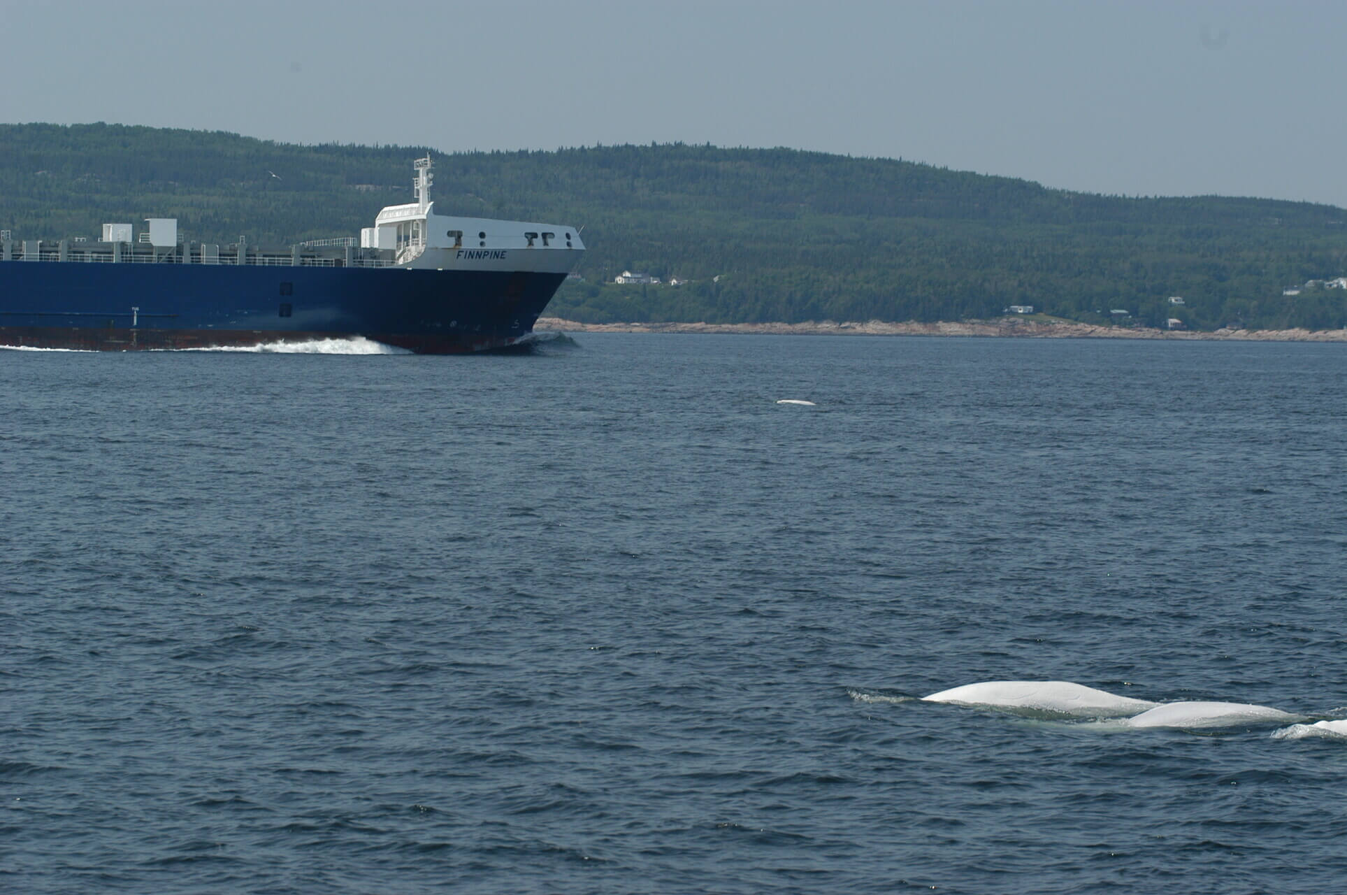
On September 16, the team detects a concentration of krill 70 m below the surface upstream from Cap de Bon-Désir in Les Bergeronnes. This is the first time this year they make such a find using the echo sounder, but a team member emphasizes that this does not mean that this is the first time krill have entered the Marine Park. Far from it! At the same time, two blue whales were spotted
in the sector. It is no coincidence. Blue whales frequent cold, deep waters and travel hundreds or even thousands of kilometres to different feeding areas such as the heart of the Estuary, where they feed mainly on krill.
Project summary
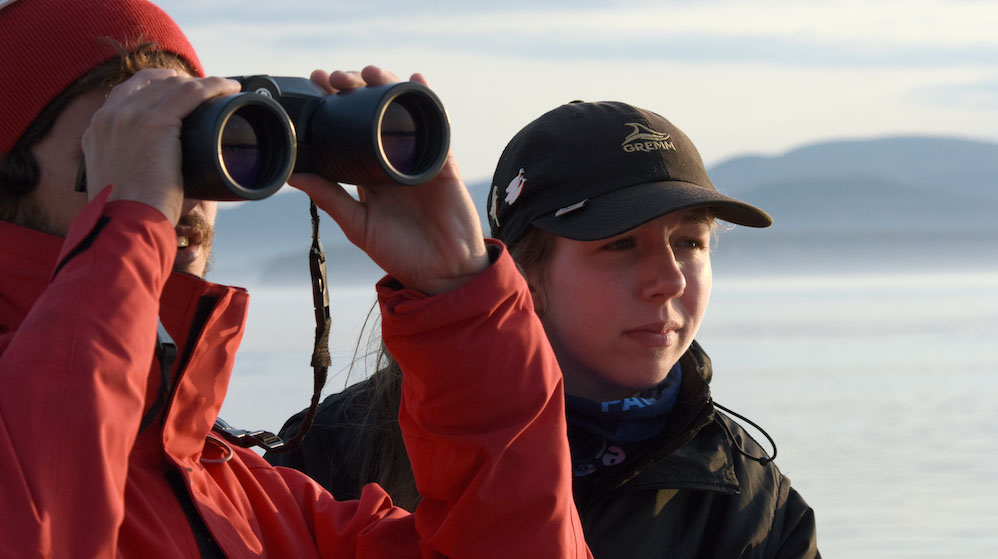
The project, now in its 4th year, aims to document the where, when and how of the whales’ diets within the Marine Park. It runs for 7 weeks beginning July 7 and is carried out twice a week: Tuesdays and Wednesdays. Target species include fin, humpback and minke whales. This project is led by Fisheries and Oceans Canada, in collaboration with the GREMM.
 To track whales under the water’s surface, researchers use a technique known as radio telemetry. The team on board the Bleuvet approaches the animal and places the tag either with a pole or by using a crossbow. The tag adheres to the back of the animal thanks to a suction cup. It then falls off on its own in less than 24 hours, floats and is recovered, the data are downloaded, and the tag is reused for another survey.
 Two whales were tracked in 2014: the humpback whale Siam on July 15 (monitored for 11 hours) and the fin whale nicknamed “Piton”, whose tag held for only thirty minutes, probably due to the presence of diatoms (microscopic algae) on the animal’s skin, which prevented the tag from properly adhering. These two trackings are in addition to six completed in 2013 and four in 2012.
Check out the project’s progress this summer to date
In parallel with the telemetric monitoring, the Parks Canada team conducts acoustic prey surveys on board L’Alliance. The concentrations and often the identity of prey in the water are estimated using the echo sounder installed on the boat. This device emits sounds that travel and strike obstacles, including living organisms. Based on the echo retransmitted by these obstacles, their position and properties can be determined and an image of their distribution in the water or of the submarine relief can be generated. Simultaneously, observers aboard the boat conduct a survey of birds and marine mammals in the area, including rorquals that can be tracked under the monitoring project carried out by Fisheries and Oceans Canada and the GREMM.
New – Monitoring of Large Rorquals at the CIMM
The telemetry project, the technique and the results obtained to date will be presented as part of a new activity organized at the CIMM in Tadoussac all summer long. The activity is offered several times a day, presented on the big screen and hosted by a GREMM naturalist.

Progress of the project over the course of the summer
August 12: Morning weather conditions were unfavourable, but by lunchtime the team had decided to head out onto the water. At 2:20 pm, a radio tag is placed on the back of fin whale Bp942, a.k.a. “Piton”. It owes its moniker to the small protuberance around its left chevron. It was first observed in 1999 and has been seen in the Estuary every year since 2010. Its sex is unknown.
The team tracked “Piton” until nightfall. The tag was still holding on its back. It finally fell off at 5:40 in the morning. The team recovered the tag the following morning at 8:35. The tracking lasted nearly 15 hours!
The graph below shows the monitoring of “Piton”.

From 2:21 pm (time of tagging) until 12:30 am, “Piton” remained feeding near the surface (between 0 and 25 m) and made a few deeper dives (approx. 40 m).
Later, between 12:30 and 1:30 am, it made two exploratory (V-shaped) dives between 90 and 115 m. It subsequently returned to the surface where it fed and rested until 4 am. Up until the time the tag fell off at 5:40, it made several (U-shaped) feeding dives to depths of between 80 and 140 m.
August 6: tracking humpback whale Gaspar under the water
This female humpback has spent much of the summer in the Gaspé; here and throughout the Gulf region, she is known as BBR (Boom Boom River). This week she’s back in the Estuary. She has been seen here every summer since 2006. On August 5 at 6:25 am, a tag is installed on Gaspar’s back. Monitoring has begun! What did Gaspar do during this monitoring?

First, between the time of the tagging and about 10:30, Gaspar was feeding by diving down to about 120 m. Subsequently, Gaspar dove less deeply and performed V-shaped exploratory dives without feeding.
Then she made some very long dives. The following figure depicts one of these long dives, which lasted about twenty minutes. We see an exploratory (V-shaped) dive followed by a period near the water surface (about 15 m deep) without feeding activity. Was she resting? Or travelling? Perhaps.

Shortly before the tag falls off (3:39 pm), Gaspar seemed to be resuming these feeding activities. She took two gulps before resurfacing.
The tracking lasted a total of nearly 9 hours 15 minutes. The maximum depth reached was 154 m.

Complete tracking of Gaspar
Throughout the day, Gaspar also struck the water surface with her pectoral fins on several occasions and took the head-down position with the two tips of her tail sticking out of the water.
July 29: Two Fin Whales Tracked during the Day
At 12:45 pm the tag is placed on fin whale Orion’s back using a pole. Monitoring is initiated as the team passes near the Prince Shoal Lighthouse. This tracking will be short, as the tag falls off just 40 minutes later. During this time, the animal dove 9 times to an average depth of 85-90 m. Its main activity: feeding.
Graph shows Orion’s diving (depth).

The Fisheries and Oceans Canada-GREMM team continues its work and, at 2:24 pm, succeeds in placing another tag on the back of fin whale Bp945 using a crossbow.
Unlike the first tracking of the day, this one lasts long… The tag was still attached to the giant when the team returned to the docks at dusk.
The next day, the team returns to the water after having “scanned” the Estuary from the promontory of the Tadoussac dunes with an antenna to locate the tag’s signal. Great news: Bp945’s tag was still holding! The animal is in the area of the head of the Laurentian Channel. The team heads back offshore, but cannot find the animal. At 10:20 am, the signal is continuous, meaning the tag fell off, thereby bringing to an end a 20-hour monitoring with heaps of data!
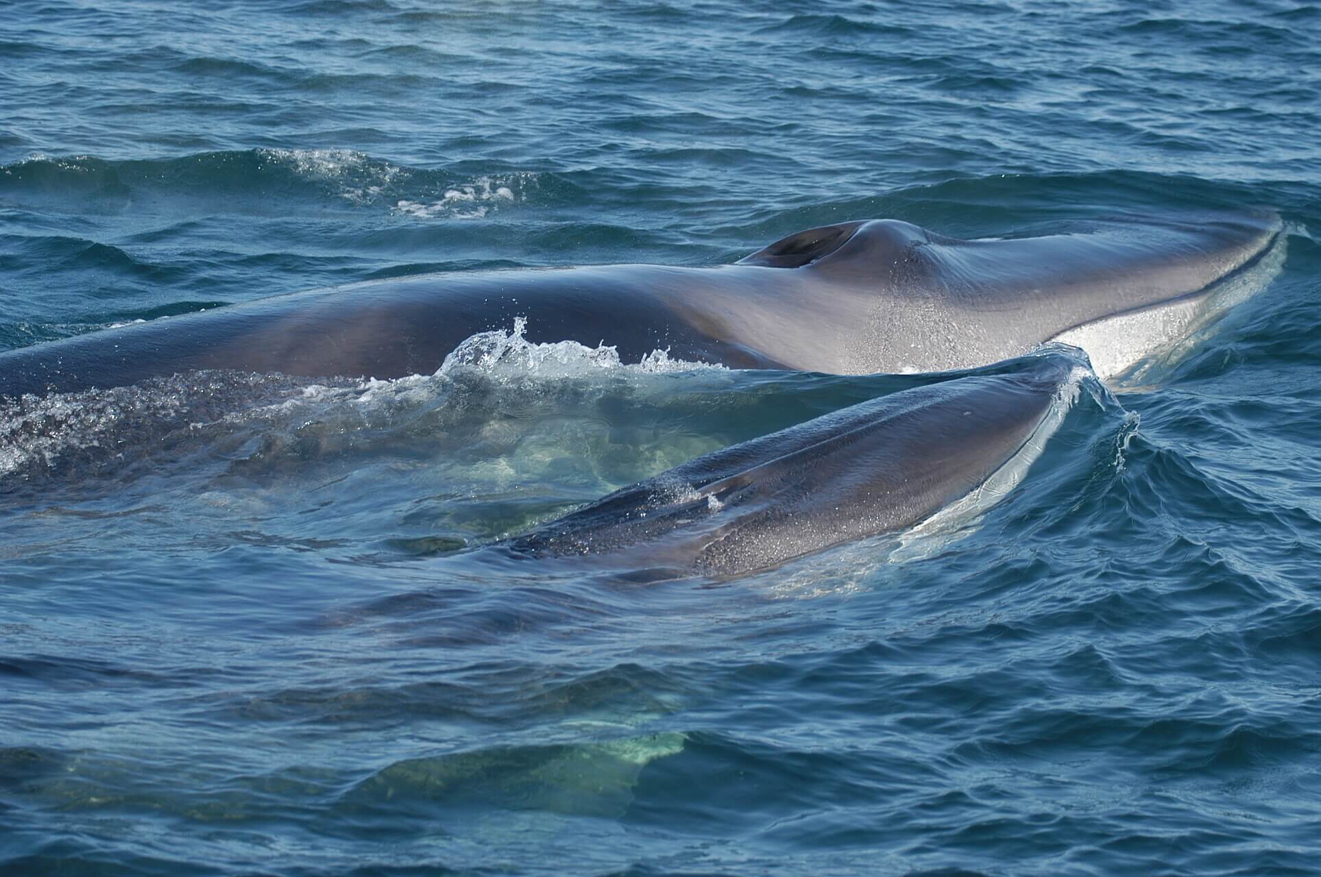
 In the coarse of the monitoring of Bp945, the team catches krill at the water surface. A little deeper, there are schools of sand lances. The fin whale fed at the water surface, turned on its side, with its huge mouth open wide.
The team from Parks Canada, a partner in the project, was also on the water.We will soon learn more about the types and abundance of prey found in the vicinity of Bp945.
What do the data reveal?
During the monitoring of Bp945, the animal dove to significant depths (around 100 m) from 2:24 to about 8 pm. From 8 pm to 4:30 am, it made shorter, shallow dives (varying between a few metres and 30-40 m). From 4:30 until the time the tag fell off, the dives were deeper again. The animal was feeding during a large portion of the tracking period, interspersed with a few periods of rest.

The following graph shows Bp945’s swimming speed (green) as a function of depth (purple). Recorded speeds peaked at 5 m/s before dropping sharply at the times of the gulps (as the animal opens its enormous mouth, the “parachute” effect is observed). When the animal was not at the surface or moving, the recorded swimming speed was about 1-2 m/s.

July 22, 2015: Bp 945 Tagged under the Water Surface
This occurred at 2:45 pm. The Fisheries and Oceans Canada-GREMM team, aboard the Bleuvet, managed to place the tag on the back of fin whale Bp 945. The tag held until 3:35, while the animal was in the midst of its sixth recorded dive.
During the first dive, it reached a depth of 123 m. Information obtained on the speed of the animal during this dive nevertheless suggests that it was not feeding at the time. Subsequently, the animal dove to depths of 60-70 m while exhibiting feeding behaviour.
The graph below depicts the dive profile of the animal:

How exactly is it possible to identify the feeding periods? It is the animal’s swimming speed and acceleration that allow us to understand and estimate the feeding frequency of rorquals, which use their ventral pouch to engulf large volumes of water and prey. Each “bite” is therefore characterized by a sharp reduction in swimming speed, like the opening of a parachute, though the whale is still in motion.
Meanwhile, the Parks Canada team detected schools of prey, possibly sand lances, near the seabed (approx. 70-80 m) in the same area where Bp 945 was.

July 14, 2015. Recap of the first tracking of the season

Several fin whales were found yesterday morning in the area of Buoy K54. In the “melee”, fin whales Orion and Bp 913 were swimming fast. As it turns out, the radio tag was actually placed on Bp 913 and not on Orion, as ID photos would later reveal.
Yesterday’s monitoring lasted about 4 hours. Relevant information is as follows:
The tag was placed on Bp 913 at 06:50 and fell off at 10:31. The suction cup was still watertight, thus the tag probably fell off not because of diminishing suction, but rather because it likely slipped off the animal’s back.
The animal reached a maximum depth of 109 m in the 32 dives it made in the course of monitoring. The animal was feeding for the entire duration of monitoring.
The water temperature stood at around 5° to 7°C at the surface, and between 0 and -1°C during dives. The VHF radio tag records, at 1-second intervals, the depth, position, direction, and speed of the animal as well as the water temperature.
The graph below depicts the depths reached during the animal’s dives.

Aboard L’Alliance, Parks Canada was also out on the water yesterday. With the echo sounder, they detected dense masses of fish with swim bladders, possibly capelin, in the area of Buoy K54. On the surface, there was considerable activity: several minke whales and hundreds of gray seals. They also detected schools of zooplankton in the water including young krill near the surface.
July 13, 2015: first tracking of the season: the fin whale Bp913
As announced last week, the telemetric monitoring project of Marine Park rorquals has begun. This morning, the fin whale Bp913 was tagged at 6:49 am, almost one nautical mile downriver from Buoy K54. Around 10:45, the radio tag fell off the animal’s back; the monitoring lasted 4 hours.
The team later tagged another fin whale, but the tag did not hold for long due to its position on the animal’s back.
June 12, 2015
In the Cap Granite area, the Parks Canada team has identified large schools of fish close to the surface, possibly capelin. Indeed, right now is the capelin spawning period in the Estuary!
Here is the echogram recorded aboard L’Alliance on June 12, 2015. Note the fish densities near the surface.

Marie-Sophie Giroux
Marie-Sophie Giroux joined the GREMM in 2005 until 2018. She holds a Bachelor’s degree in Marine Biology and a diploma in Environmental Consulting. As Lead Naturalist, she oversees and coordinates the team working at the Marine Mammal Interpretation Centre and writes for Whales Online and Whale Portraits. She loves to share “whale stories” with visitors to the CIMM and readers alike.
Recommended articles
Coexistence in Troubled Waters: A Participatory, Multi-Criteria Approach to Beluga Protection
By Maud Thermes, Irène Abi-Zeid, Nathalie Niquil, Franck Taillandier and Arnaud Sentis A majestic emblem of the Saguenay–St. Lawrence region,…
Peering into the Hidden World of Whales through Biopsies and Tagging!
Marine mammal research is fraught with challenges. Scientists must study massive animals that inhabit vast environments and spend most of…

How’s the St. Lawrence doing?
Rising water temperatures, acidification, dwindling ice cover, plastic and chemical contaminants… The changes currently taking place in the St. Lawrence…